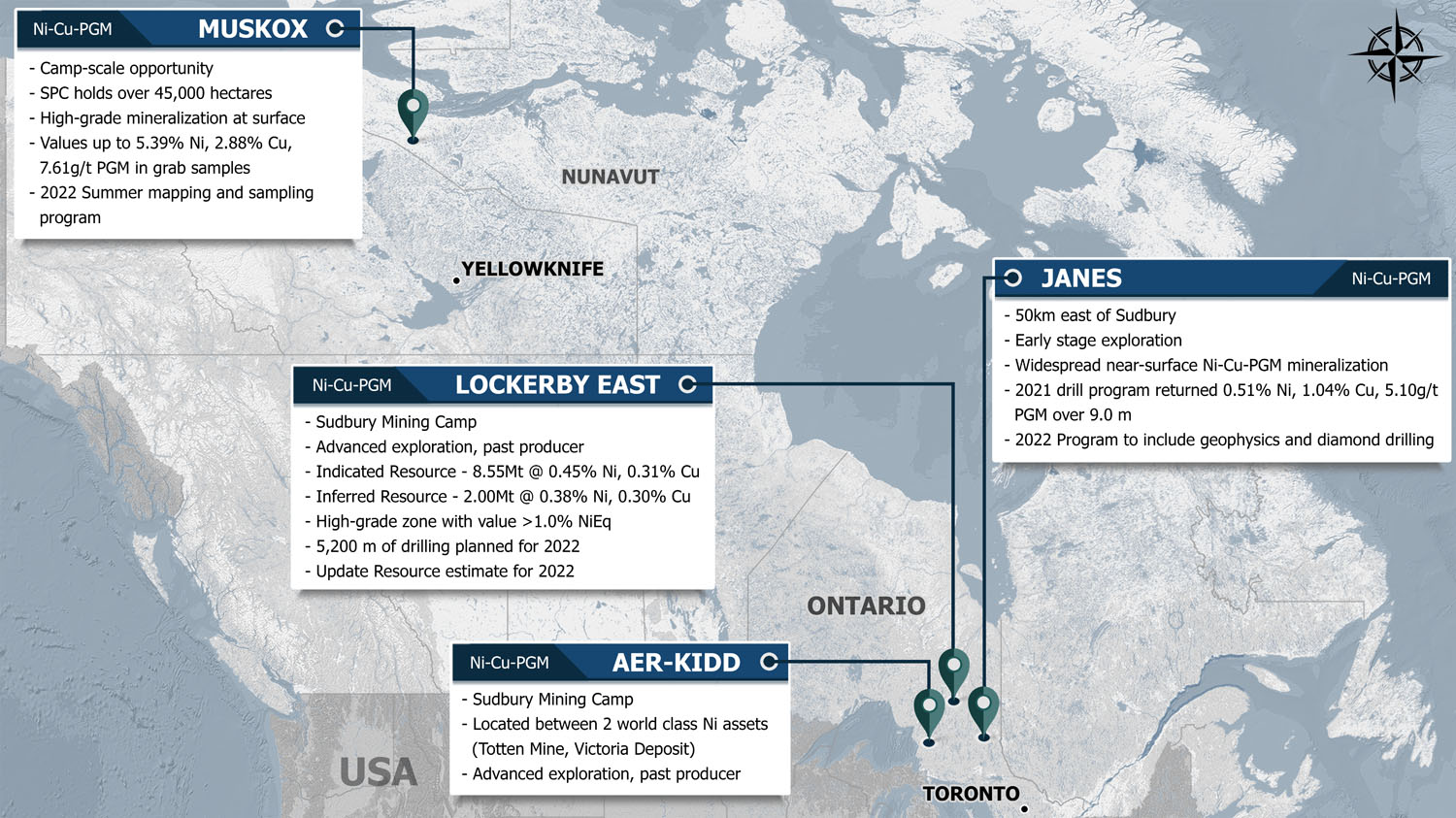
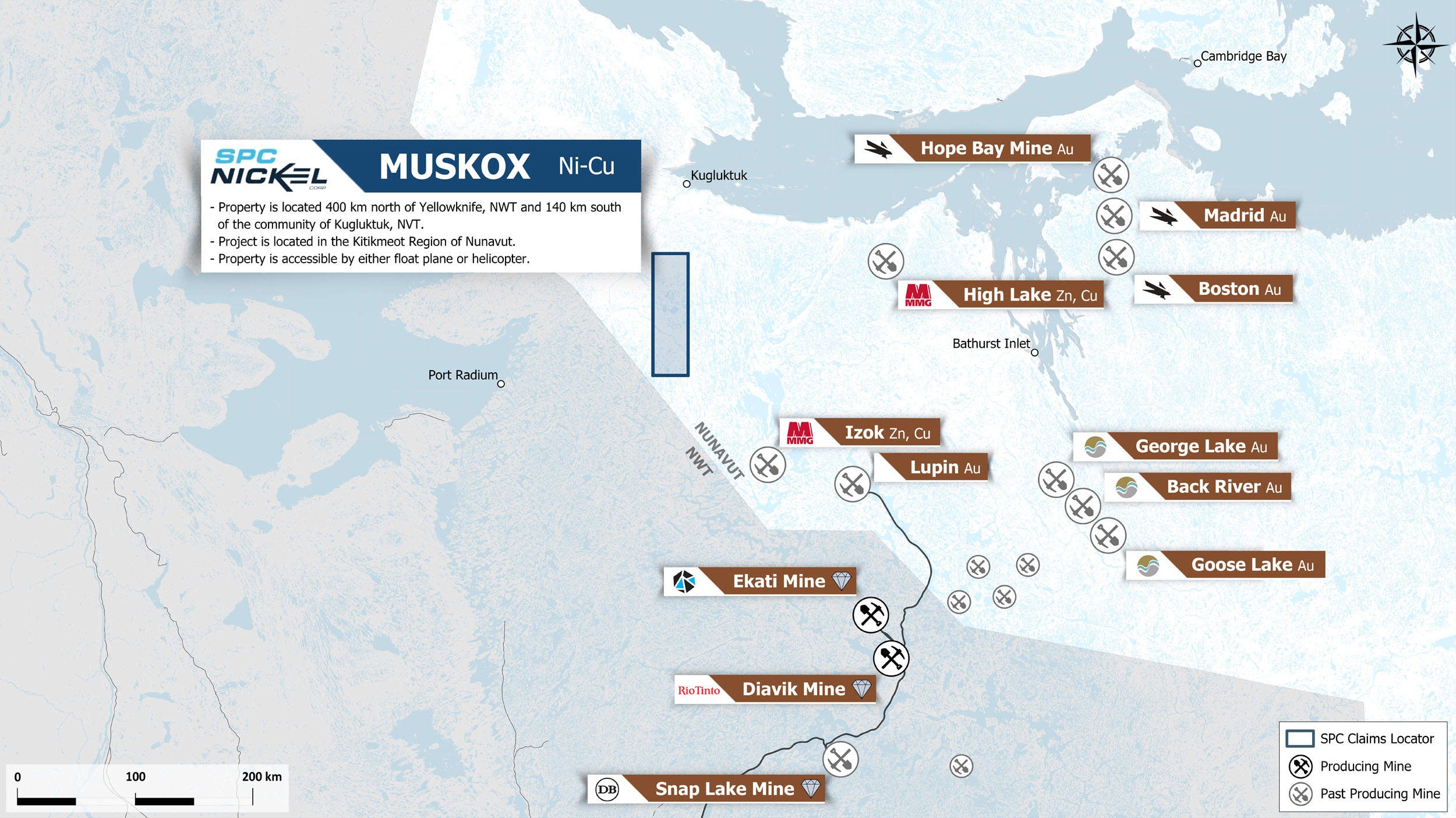
Muskox Project, Nunavut, Canada
Project Snapshot |
|
|---|---|
|
Status |
Exploration Stage - District Scale |
|
Location |
Nunavut, Canada |
|
Commodity |
Copper, nickel, and platinum-group metals (PGM) |
|
Ownership |
100% Owned mining claims and Option Agreement with Bathurst Metals |
|
Current exploration |
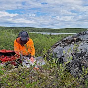
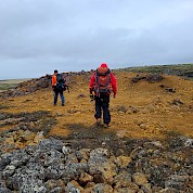
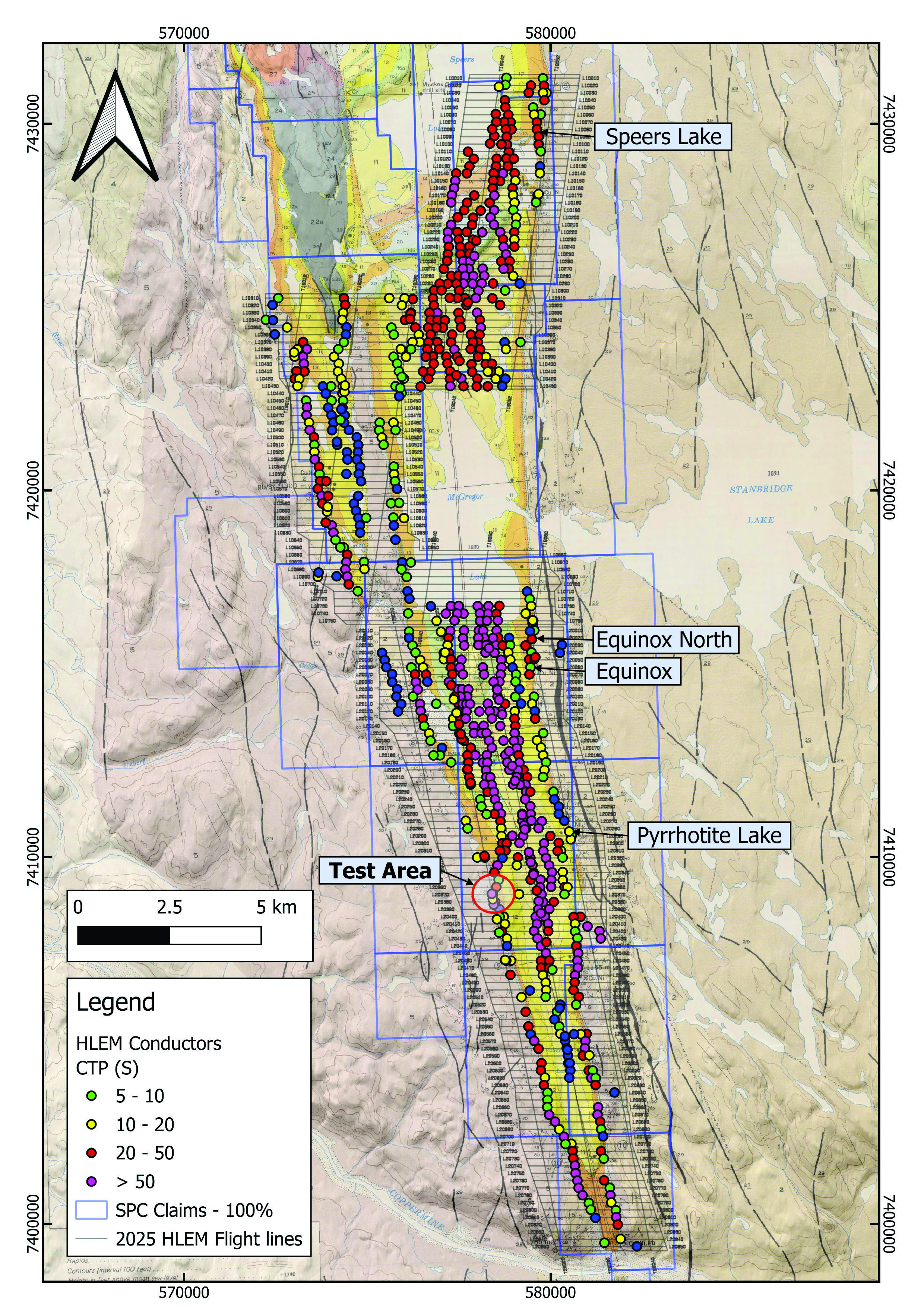
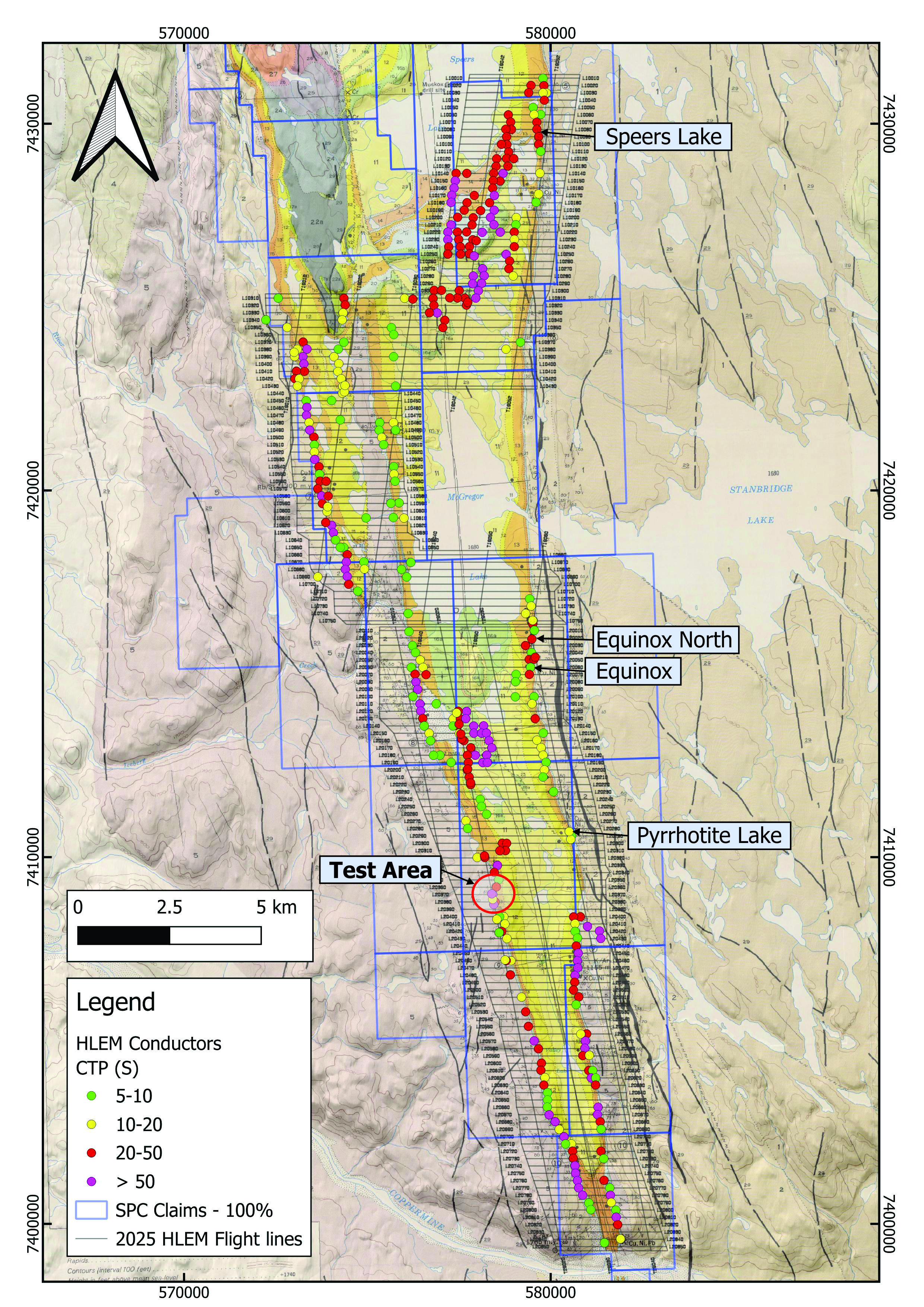
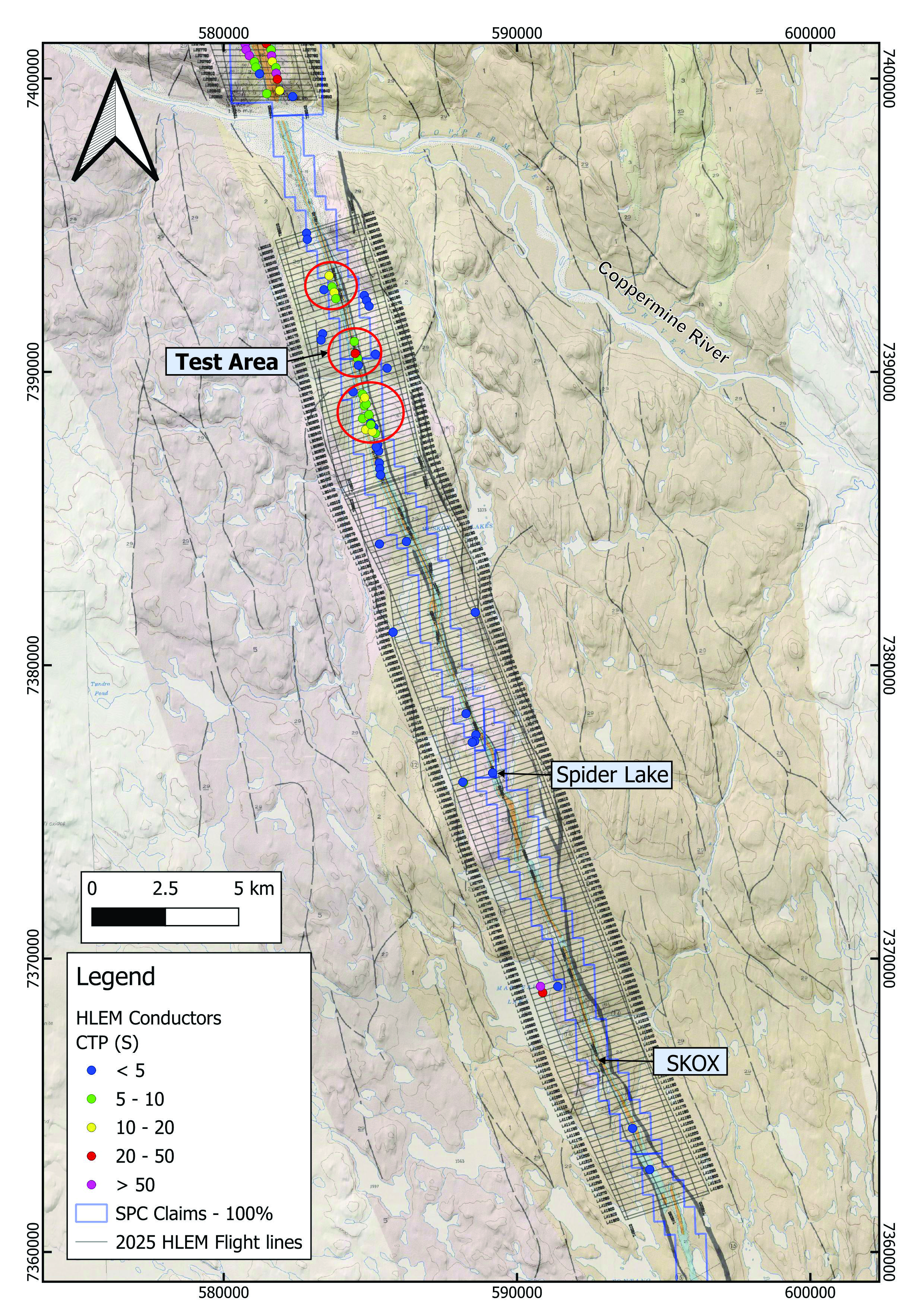
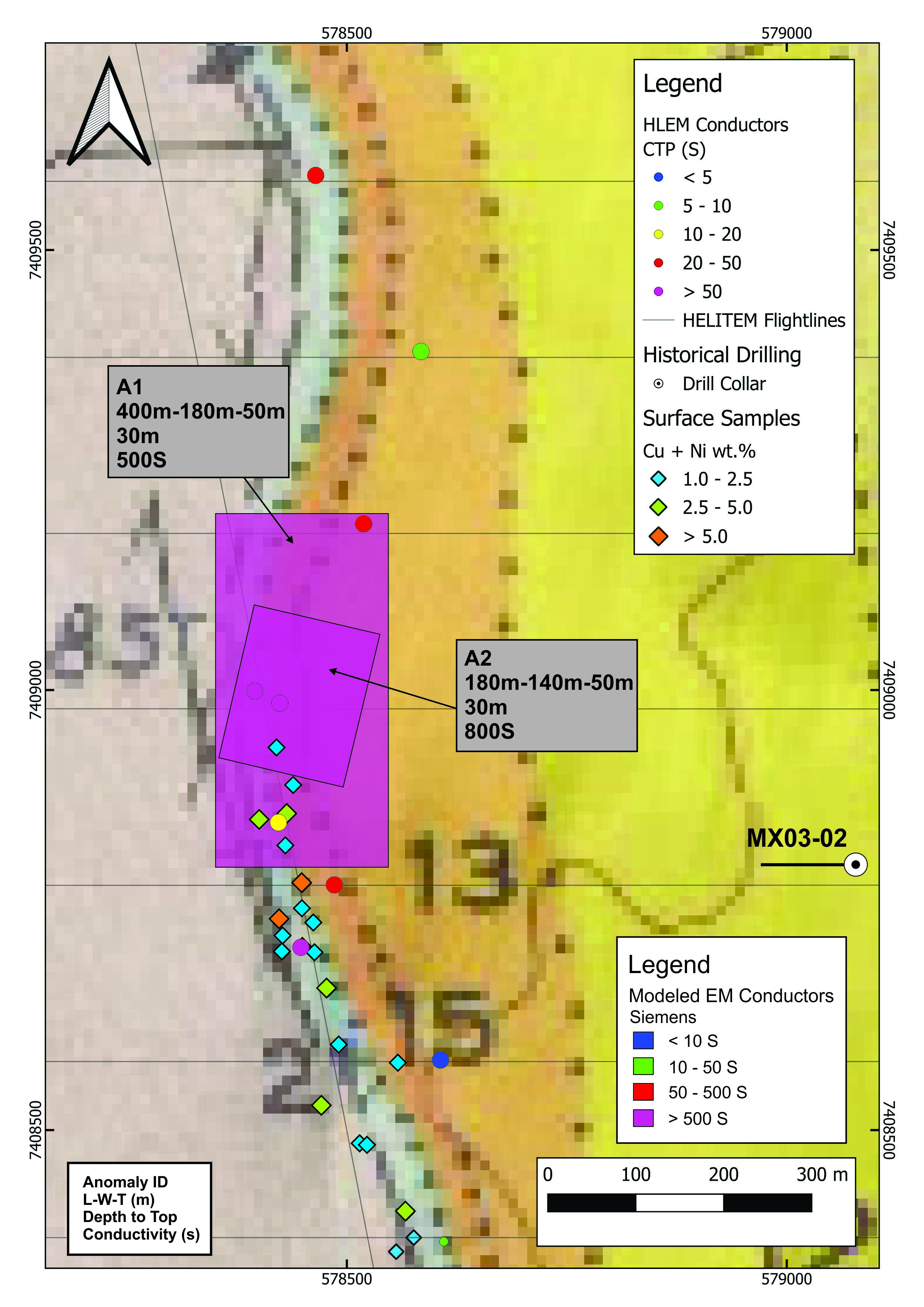
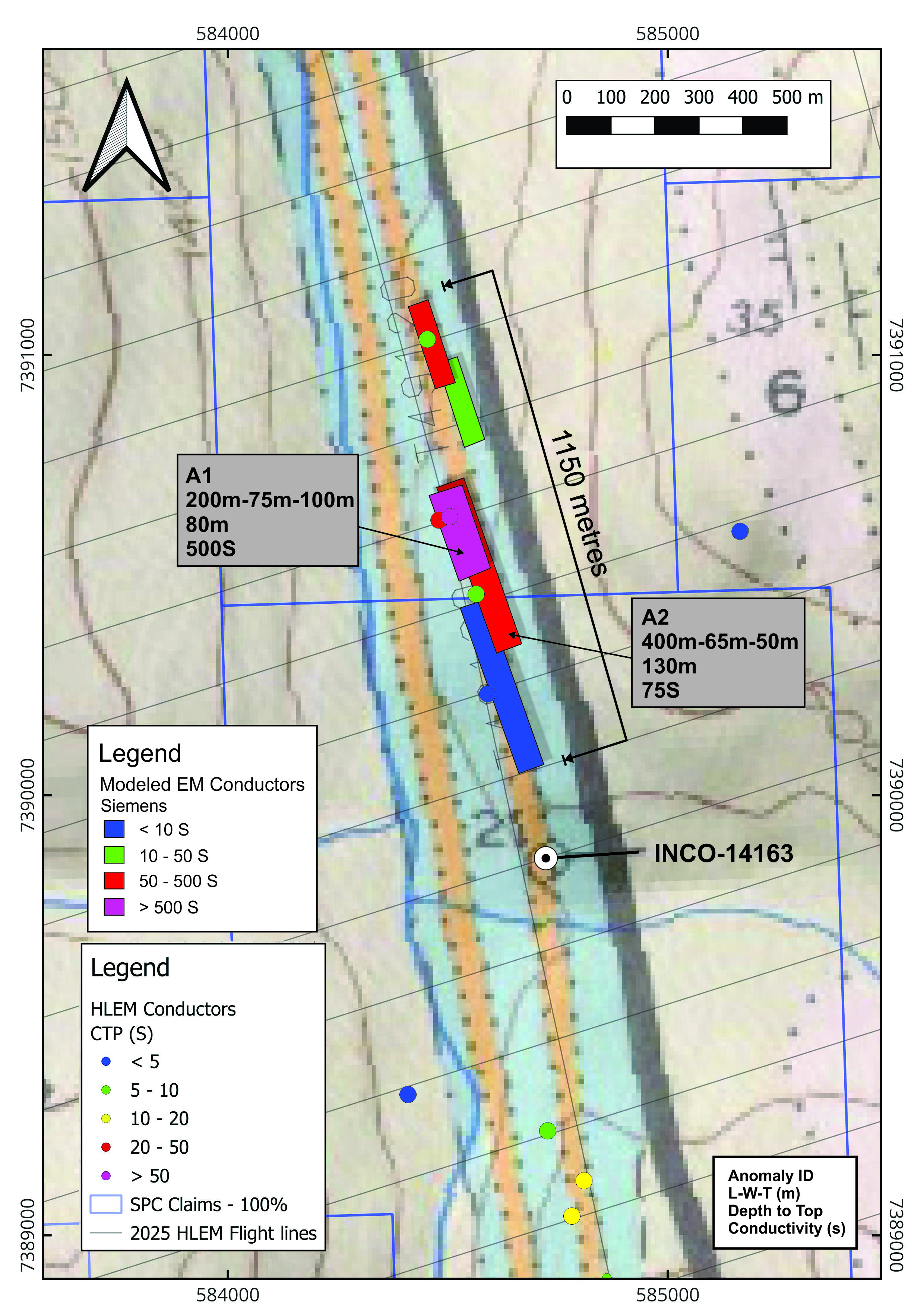
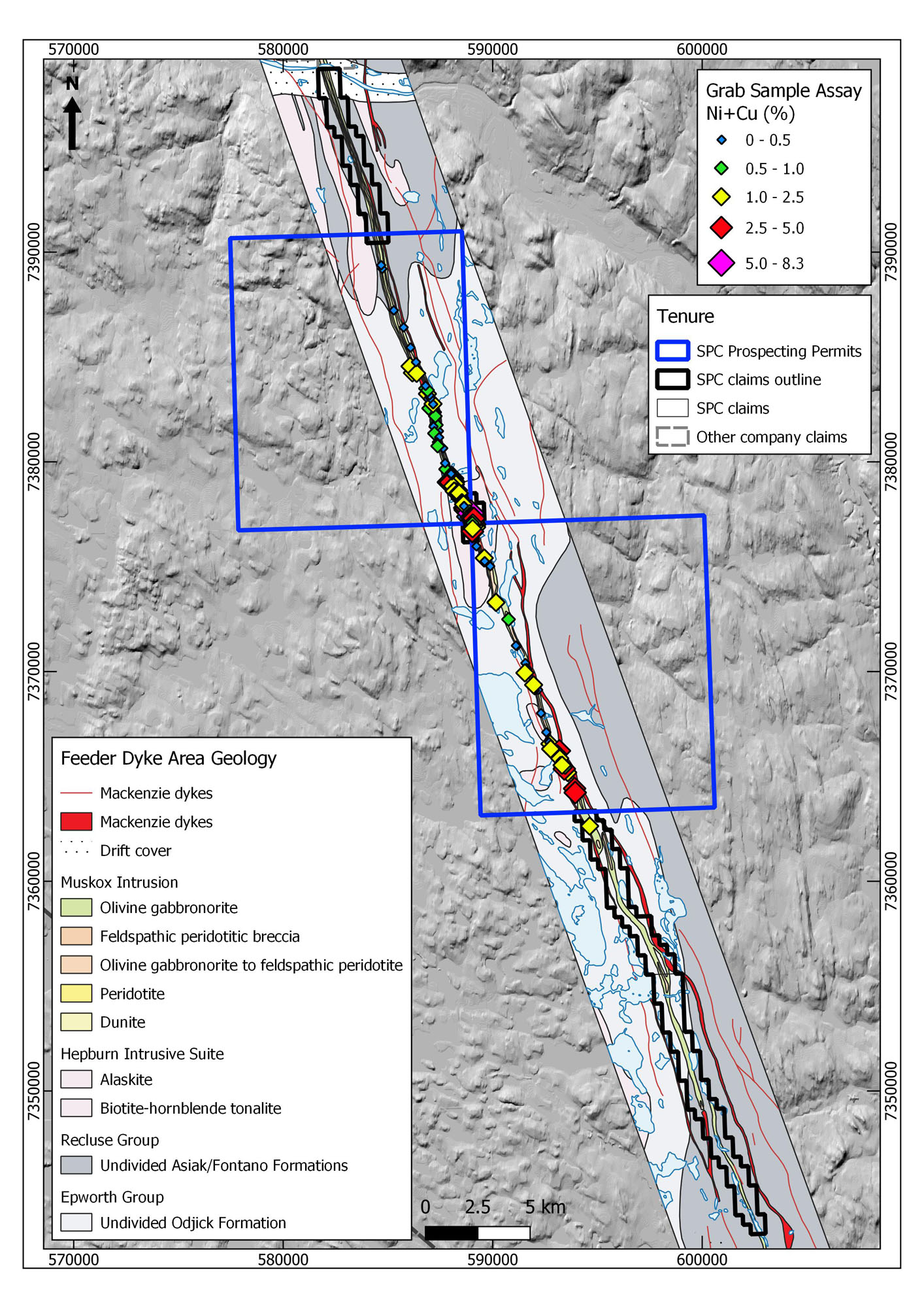
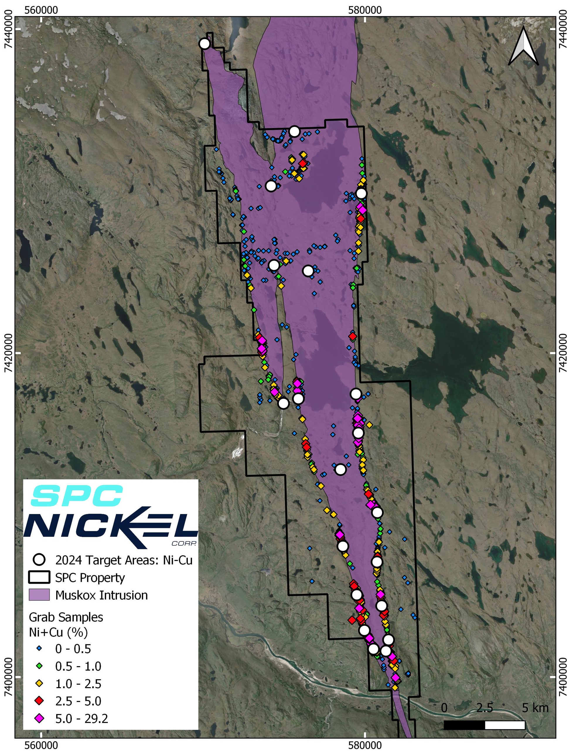
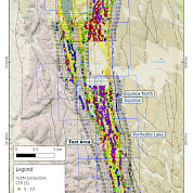
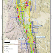
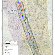
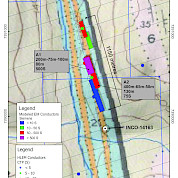
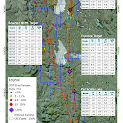
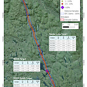
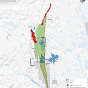
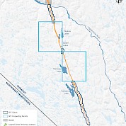
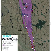
In July 2025, SPC Nickel completed a MobileMT survey, the first of its kind over the highly prospective Muskox Intrusion and the first airborne geophysical survey completed in over 20 years on the Project. The survey collected deep-penetrating geophysical data to help map potential conductive targets beneath the Muskox Intrusion. In preparation for this work, SPC Nickel strategically expanded its land position by staking an additional 65 km², increasing the Muskox Project’s total size and further consolidating its control over the most prospective ground in the region. SPC Nickel followed up the MobileMT survey with and a comprehensive field program that included mapping and sampling beginning in August 2025. Finally, 2025 exploration included a low-frequency large loop airborne electromagnetic (EM) survey to identify large EM anomalies that can potentially be linked to massive sulphide mineralization. Results from the 2025 surface sampling program, reported in November 2025, confirmed widespread high-grade copper, nickel and PGM mineralization across multiple target areas within both the main Muskox Intrusion and the 60 km Feeder Dyke. In December 2025, SPC Nickel announced that the property-wide HELITEM low-frequency EM survey had identified 85 strong conductors within 1,410 line-km of data, many of which coincide with known Cu-Ni-PGM mineralized zones or define compelling new targets along the margins of the Muskox Intrusion and within the Feeder Dyke. This first modern, project-wide EM dataset in more than two decades has significantly expanded the pipeline of high-priority, drill-ready targets and will underpin a focused, data-driven exploration program at Muskox going forward. |
-
Overview
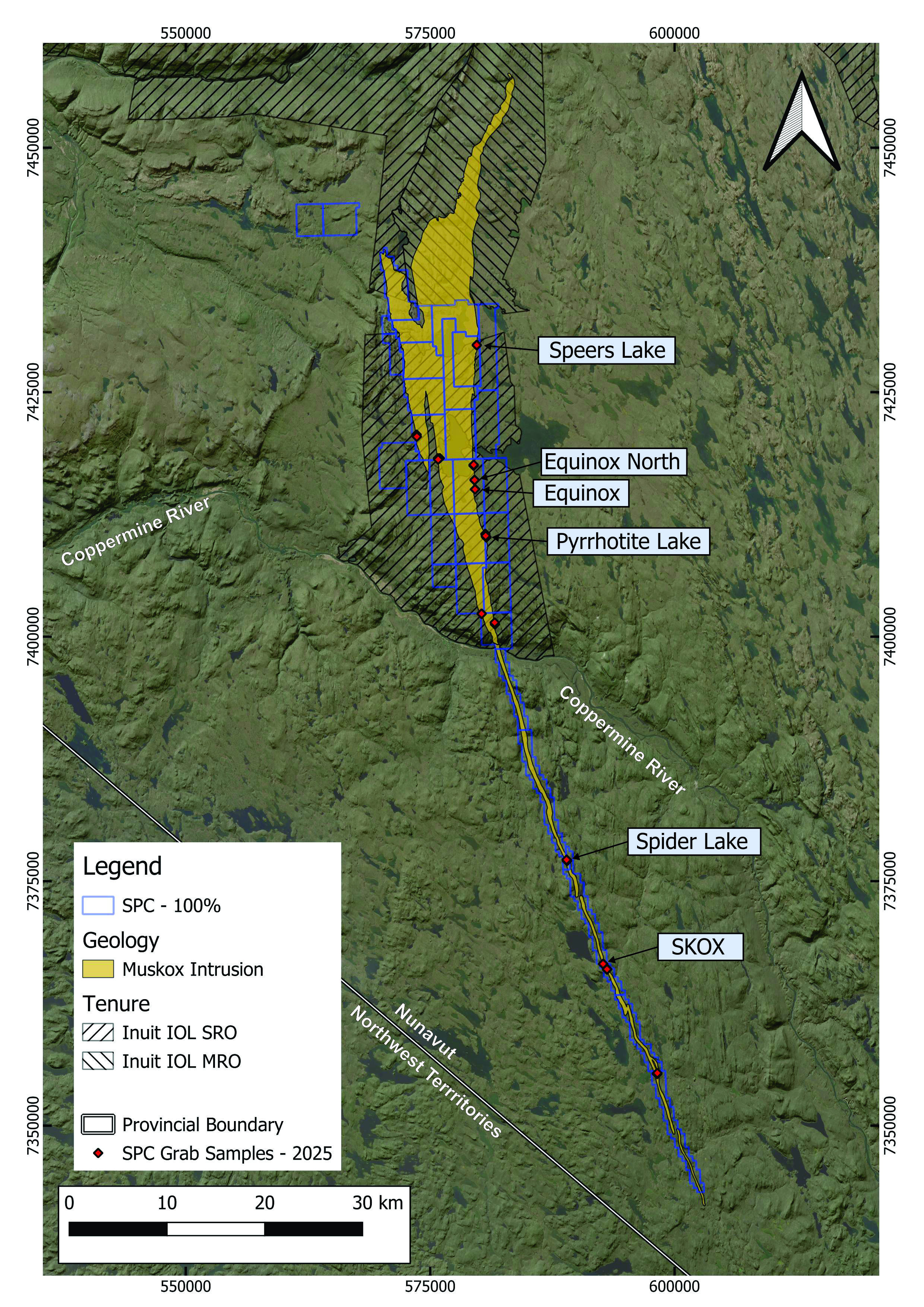
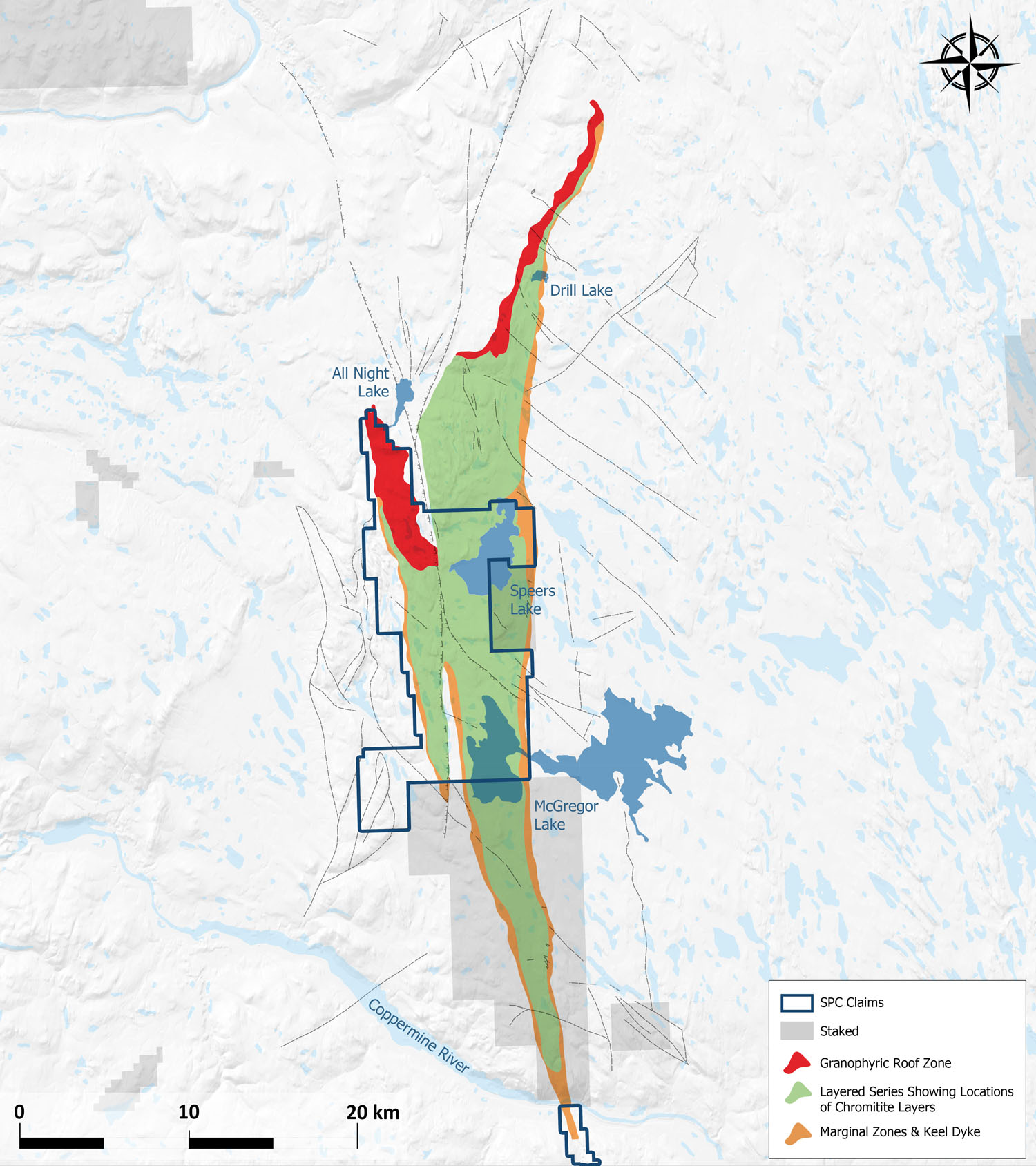
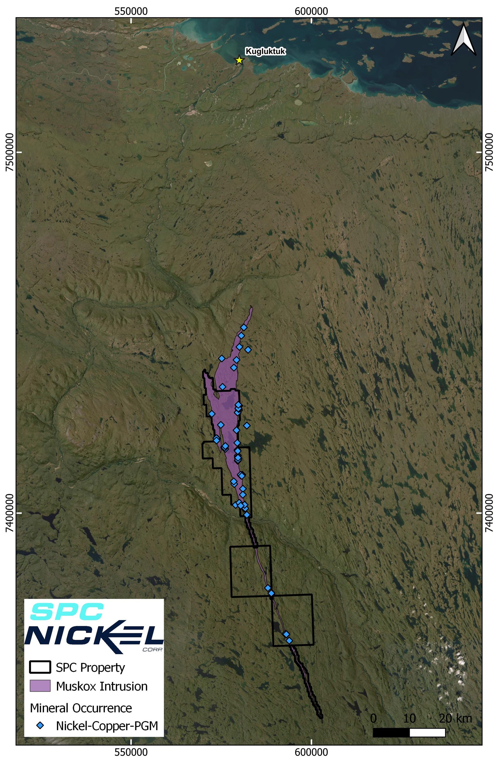
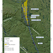
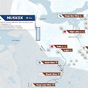
The Muskox Property is located in Nunavut, Canada approximately 400 km north of Yellowknife, NT and 75 km south of the community of Kugluktuk, NU. The property is within the Kitikmeot Region of NU and is comprised of 26 mining claims and 2 prospectors permits for a total of 49,600 hectares. The Muskox Property represents a district-scale Cu-Ni-PGM opportunity that has similarities to many of the world's well-known copper-nickel camps including Noril’sk, Voisey’s Bay and Sudbury.
-
Project Presentation
-
Brief History
The Muskox Intrusion was discovered in the 1950’s by Inco during an airborne survey identifying tens of km’s of gossans extending across the tundra. Inco completed an extensive exploration program including drilling a total of 117 holes which returned significant intersections at Pyrrhotite Lake including 12.49 metres @ 1.75% Ni, 3.79% Cu and at Speers Lake including 1.13 m @ 3.5% Ni, 9.3% Cu. Inco's exploration priorities then shifted from the region to focus on the Thompson Nickel Belt.
Between 1960 and the mid 2000’s several other junior and major companies, including BHP, Equinox Resources, Muskox Minerals, Anglo American Exploration Ltd and Silvermet Inc., conducted exploration programs on the property. Highlights from the work include drilling completed by Equinox Resources Ltd. at Pyrrhotite Lake which returned 13.74 metres @ 2.21% Ni, 5.04% Cu. The last active exploration program completed on the Muskox Intrusion was Silvermet Inc. in 2008.
In 2021, SPC Nickel announced that it had acquired, through staking, a significant land position totalling 47,500 hectares, on the highly-prospective Muskox Intrusion. That same year, SPC Nickel acquired a large comprehensive database related to the exploration of Muskox Intrusion. The proprietary database, that is exclusive to SPC, represents over 15 years of exploration and four multi-year programs conducted back to 1955 and is estimated to easily be equivalent to cost 15 million dollars in modern exploration expenditure. The database includes results from over 5,600 line km of airborne magnetics and electromagnetic surveys, 466 line km of ground geophysics which include VLF, HLEM, Gravity, MT and AMT. It also includes geological and geochemical data from over 261 diamond drill holes totaling more than 35,000 metres.
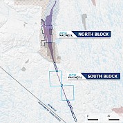
In March of 2023, SPC Nickel announced that it had entered into an Option Agreement with Bathurst Metals Corp. giving SPC Nickel the right to acquire a 100% interest in the 17,840 hectare McGregor and Speers Lake properties. Following this transaction, SPC Nickel now controls all of the Muskox Intrusion that is available for staking.
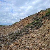
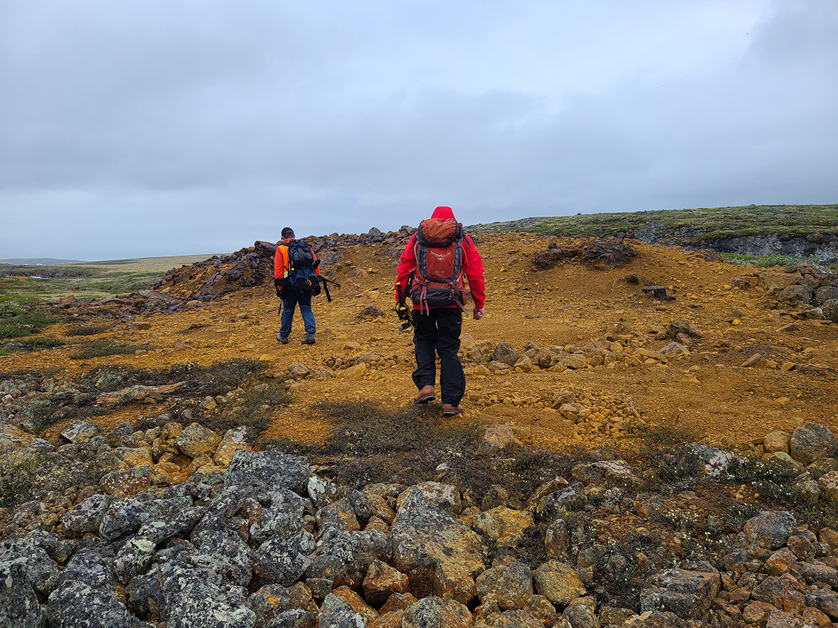
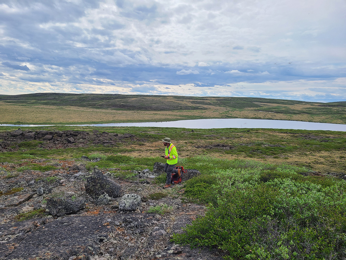
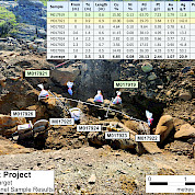
During the summer of 2024 SPC Nickel initiated a surface exploration program at Muskox that included geological prospecting, rock sampling, geochemical sampling and mapping. Results from the field work will be incorporated into SPC Nickel’s proprietary database and used to refine existing exploration targets, generate new exploration targets and to further advance SPC Nickel’s understanding of the Muskox Intrusion. The primary objective of the surface program was to evaluate the numerous high priority targets identified during a historical data compilation and analysis of satellite imagery of the Project. To date, SPC Nickel has identified 19 Ni-Cu-PGM targets directly associated with the Muskox Intrusion.
In July 2025, SPC Nickel completed a MobileMT survey, the first of its kind completed over the highly prospective Muskox Intrusion and the first airborne geophysical survey completed in over 20 years on the Project. The survey collected deep-penetrating geophysical data to help map potential conductive targets beneath the Muskox Intrusion. In preparation for this work, SPC Nickel strategically expanded its land position by staking an additional 65 km², increasing the Muskox Project’s total size and further consolidating its control over the most prospective ground in the region. SPC NIckel followed up the MobileMT survey with a comprehensive field program beginning in August 2025.
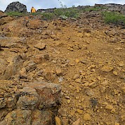
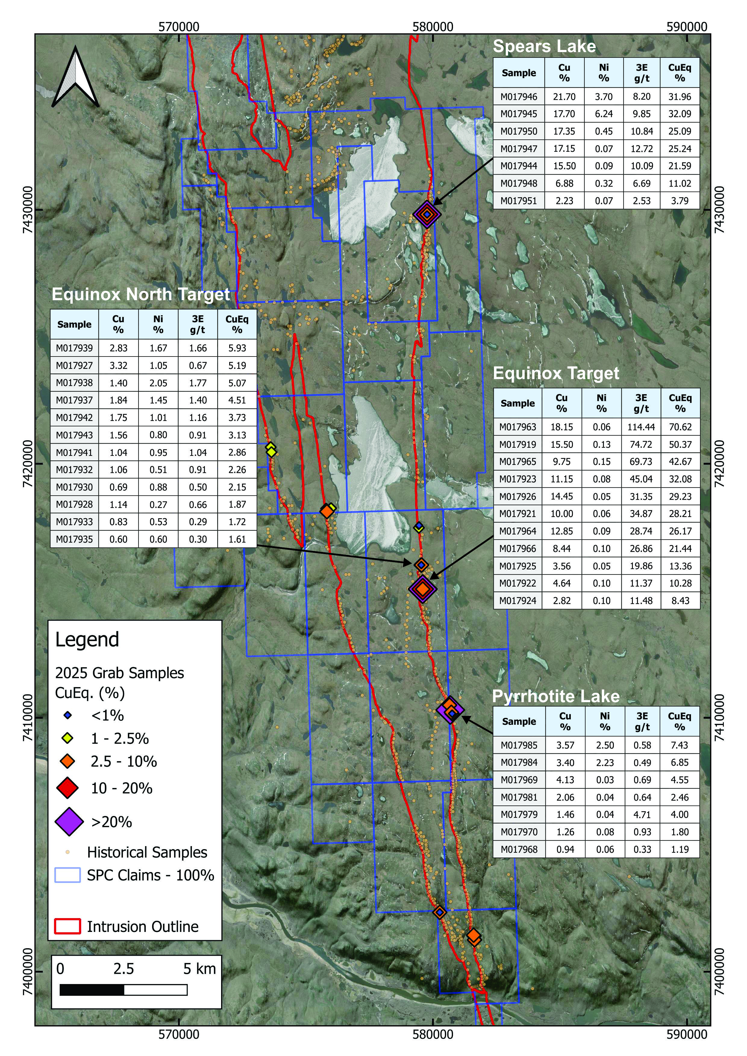
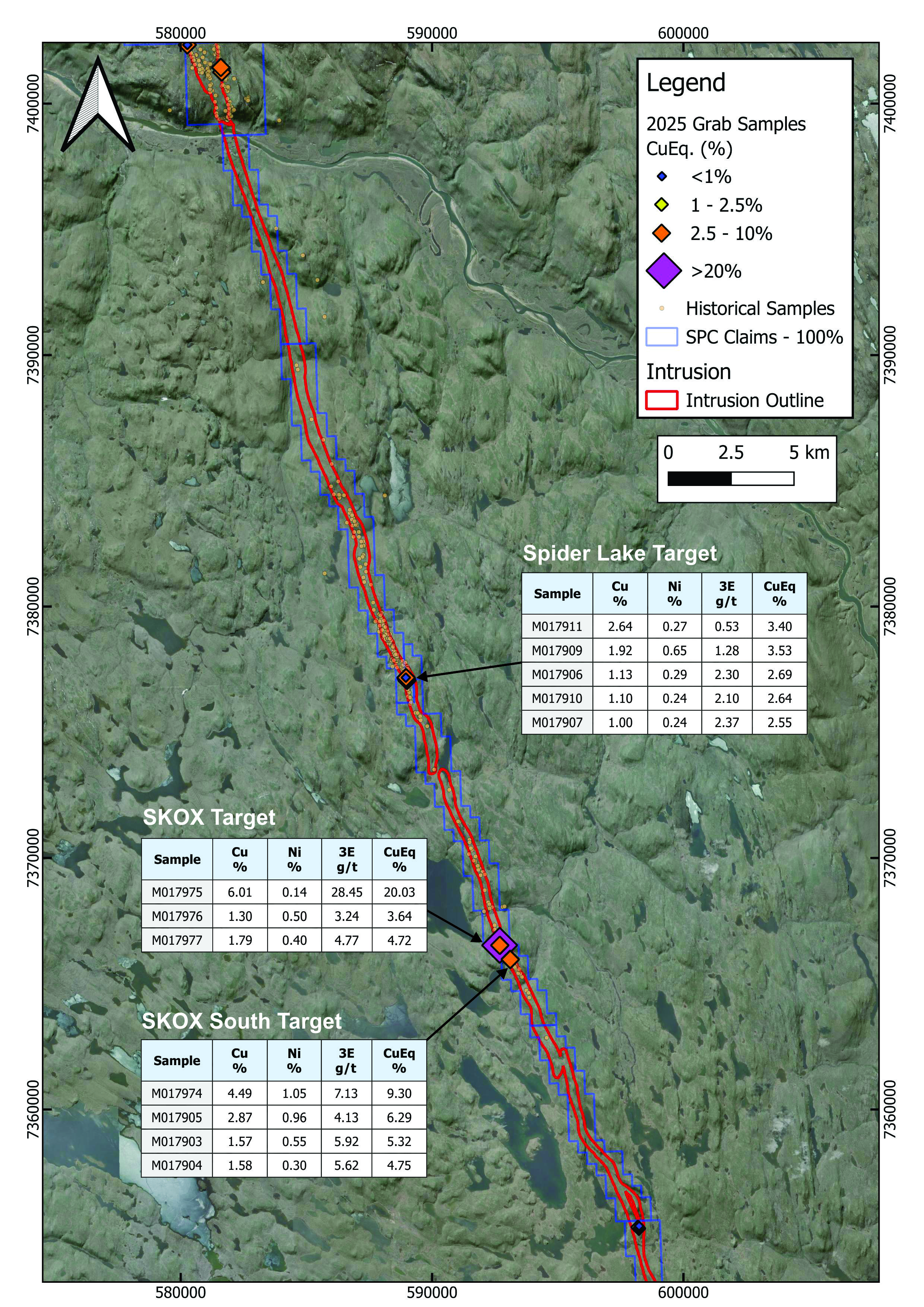
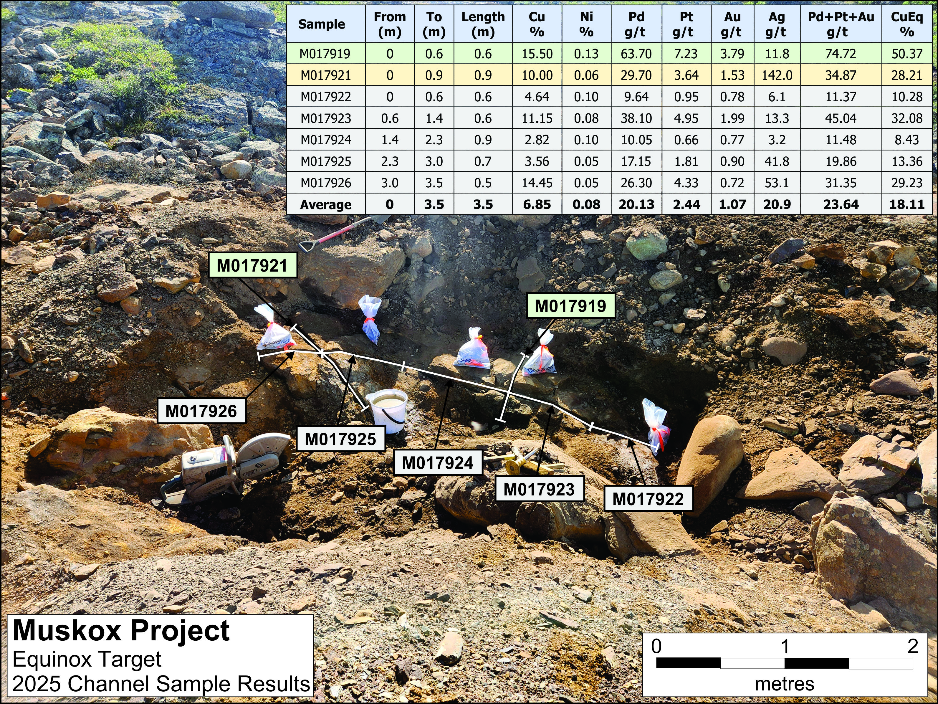
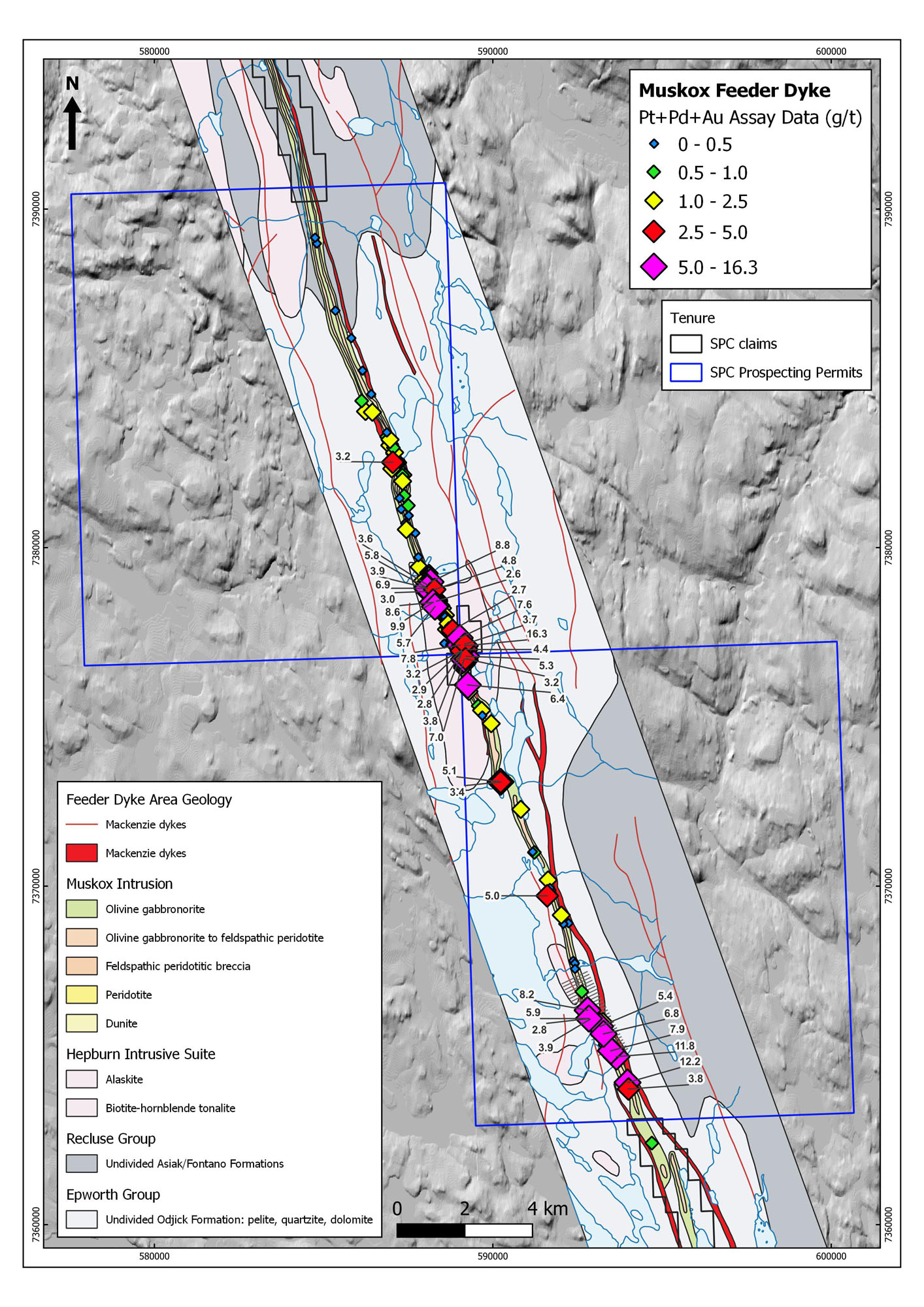
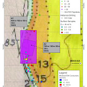
Results from the 2025 surface sampling program, reported in November 2025, confirmed widespread high-grade copper, nickel and PGM mineralization across multiple target areas within both the main Muskox Intrusion and the 60 km Feeder Dyke, with highlight samples returning grades up to 18.15% Cu and 114.44 g/t PGMs at Equinox and over 30% CuEq at Speers Lake. These consistently high-grade results, together with multiple mineralization styles and broad target distribution, reinforce Muskox as a large-scale, metal-bearing district with potential to host multiple deposits. In December 2025, SPC Nickel announced that the property-wide HELITEM low-frequency EM survey had identified 85 strong conductors within 1,410 line-km of data, many of which coincide with known Cu-Ni-PGM mineralized zones or define compelling new targets along the margins of the Muskox Intrusion and within the Feeder Dyke. This first modern, project-wide EM dataset in more than two decades has significantly expanded the pipeline of high-priority, drill-ready targets and will underpin a focused, data-driven exploration program at Muskox going forward.
-
Project Highlights
The results from our summer 2025 field program underscored the unique geologic potential of the Muskox Project and position it as a leading exploration opportunity possessing the scale and mineralization typically associated with world-class copper-nickel districts. Standout results included CuEq grades up to 70.62% at Equinox, multiple samples above 30% CuEq at Speers Lake, and consistent high-grade Cu-NiPGM mineralization across all target areas.
In additon, the Muskox Project is characterised by
- Numerous similarities to many of the world’s largest nickel mining camps – Norilsk, Sudbury, Voisey’s Bay mining districts
- Well established geological settings and fertile system confirmed by highgrade historic drill intersections and grab sample
- Historical drill results underscore the exceptional mineral potential of the Muskox Intrusion, including:
- 7.50 metres @ 6.14% Cu, 2.76% Ni and 9.06 g/t PGM (Pt+Pd+Au) by Silvermet Corporation in 2007 and
- 13.74 metres @ 5.04% Cu, 2.21% Ni and 5.63 g/t PGM by Equinox Resources Ltd. in 1987
Average depth of drilling is only 135 metres.
-
Background
- Discovered by Inco in the 1950’s
- One of the largest and least deformed layered intrusions in the world
- Similar geological environment as many of the world’s largest nickel districts (Norilsk, Sudbury, Voisey’s Bay)
- Represents the plumbing system for one of the largest “Large Igneous Provinces” on the planet (Mackenzie Event)
- Approximately 125 km long, and ranges from 200–600 metres wide in the feeder dyke to 11 km wide in the main body of the intrusion
Mineralized Environment: Cu-Ni-PGM mineralization has been identified in 4 separate and distinct geological environments
1. Basal Contact and Footwall (Cu-Ni-PGM)
- Examples: Norilsk-Talnakh, Voisey’s Bay, Sudbury
2. Keel Zone (Cu-Ni-PGM)
- Examples: Voisey’s Bay
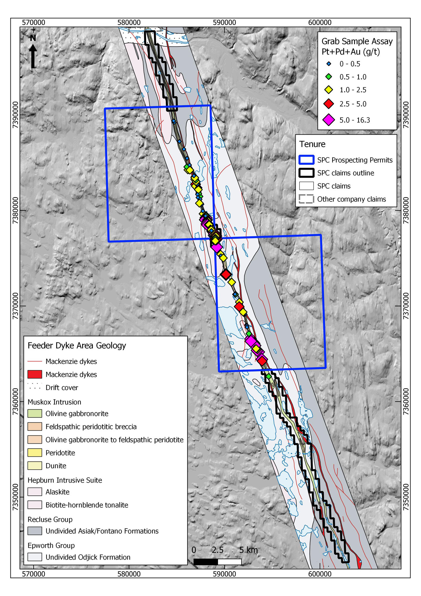
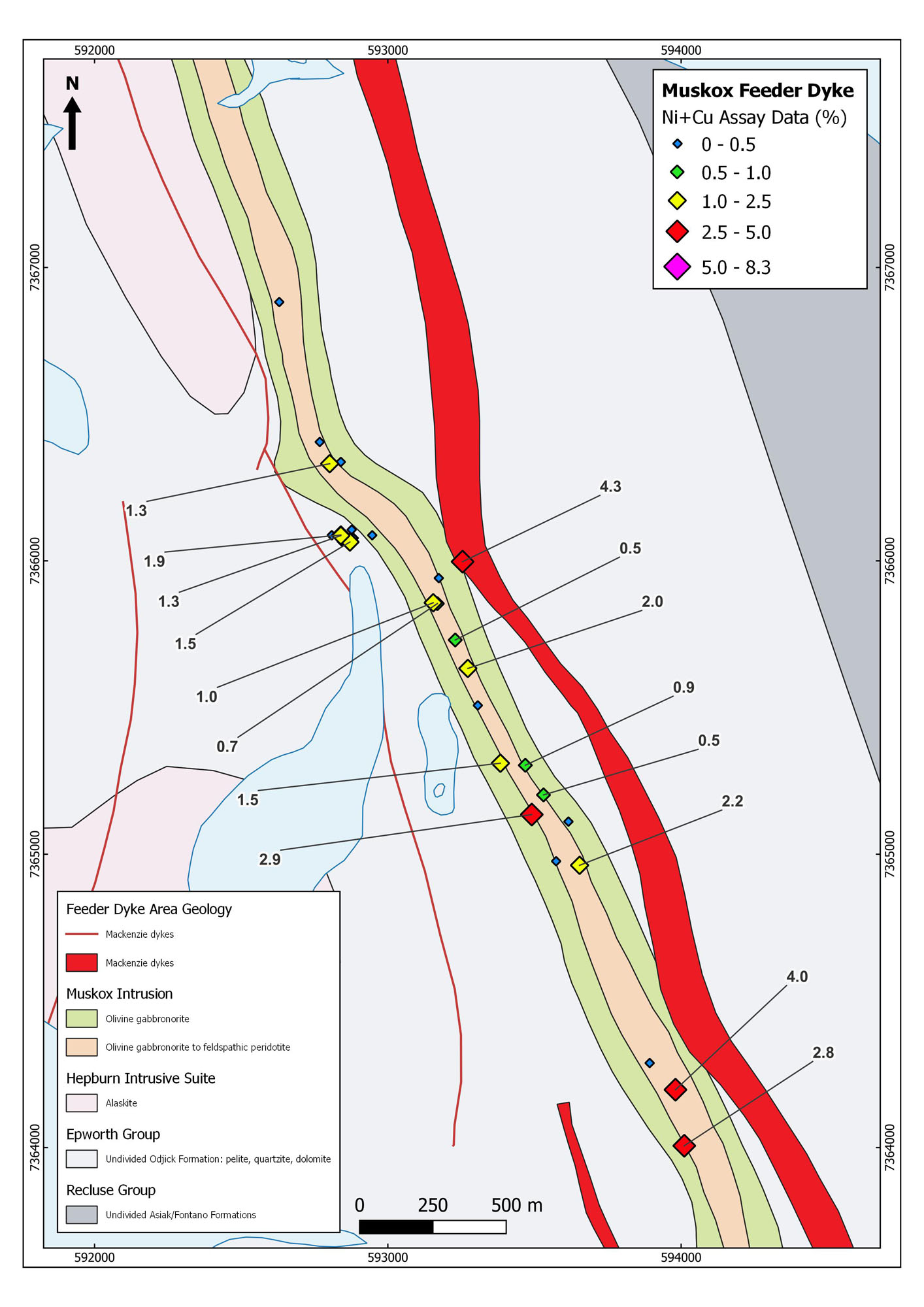
3. Feeder Dyke (Cu-Ni-PGM)
- Examples: Voisey’s Bay, Sudbury
4. Stratiform Reefs (Pt-Pd-Rh-Cr)
- Examples: Bushveld, Stillwater
-
Geology and Mineralization
The Muskox Intrusion is one of the largest and least deformed layered mafic to ultramafic bodies in the world. It intruded as an elongate funnel-shaped body along a feeder dyke to the Coppermine flood basalts, at or near the unconformity between the underlying Early Proterozoic (1.8 to 2.1 Ga.) schists and gneisses of the Coronation Supergroup and the overlying undeformed rocks of the Hornby Bay and Dismal Lake groups (the basal strata of the Coppermine Homocline). The exposed portion of the intrusive complex is approximately 125 km long, and ranges in width from 200 metres - 600 metres in the keel dyke to 11 km in the main body of the intrusion. Three deep drill holes collared by the Geological Survey of Canada during the 1960’s intersected a stratigraphic thickness of 1,900 metres in the central exposed portion of the intrusion. Magnetic data indicate that the intrusion continues at least 100 km to the north of the last exposure, under the Coppermine Homocline. Gravity data suggest that it is even larger, and may continue northward for 250 km from its northernmost exposure. The Muskox Intrusion is thus interpreted as the magma chamber for the early Coppermine flood basalts, with the dense, Mg-rich olivine cumulates remaining behind in the magma chamber while less magnesian basalts erupted to flood the surface.
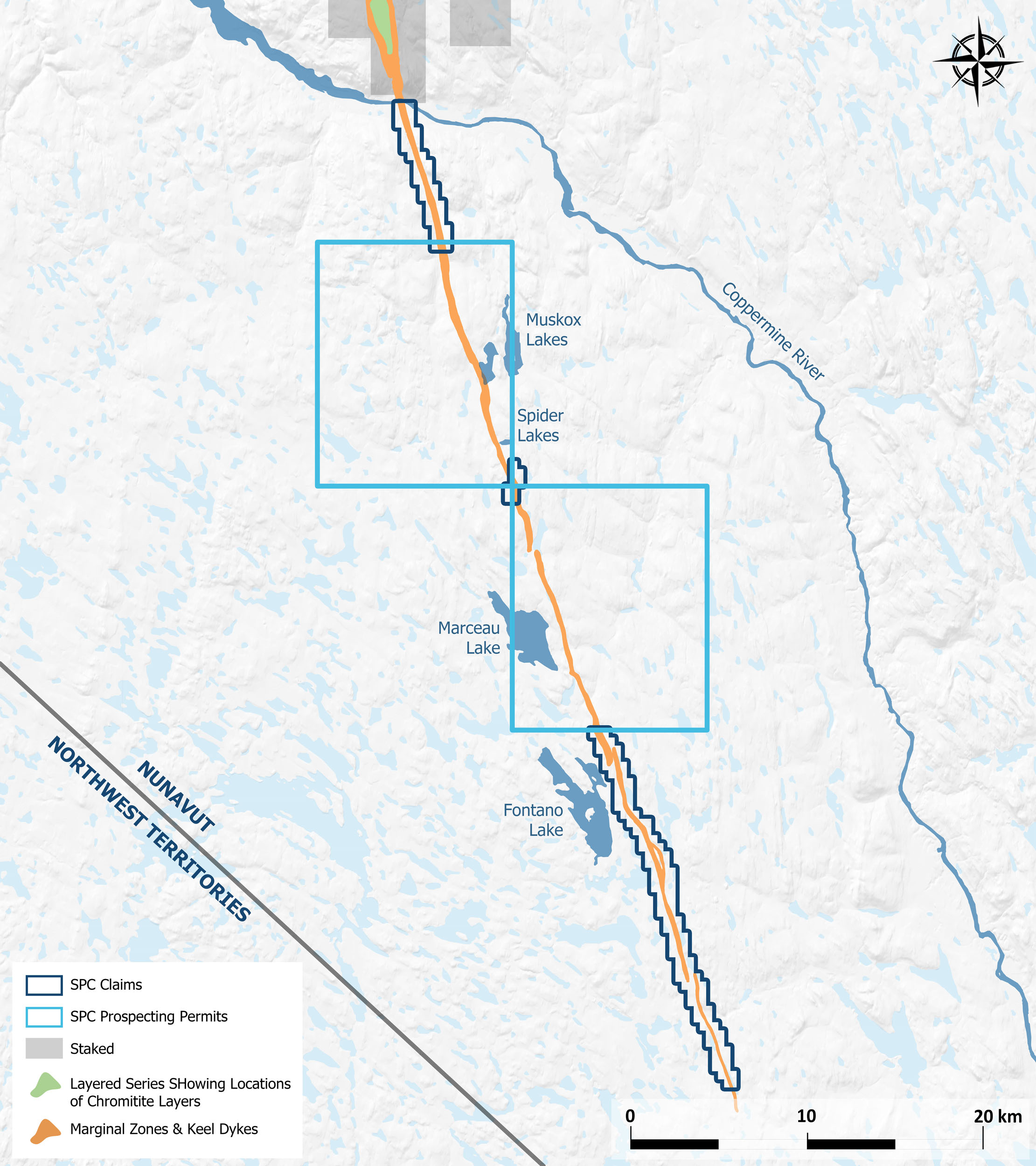
Because of the gentle north dip of the Muskox Intrusion (and overlying rocks of the Coppermine Homocline), increasingly deep levels are exposed south along the length of the intrusion. South of the Coppermine River, the layered series is eroded, and only the feeder dyke is exposed. This feeder dyke thins from as much as 600 metres near the Coppermine River to 200 metres along its exposed length of at least 60 km to the south.
The geology of the Muskox Intrusion is comprised of 4 key units called the Keel (Feeder) Dyke, Marginal Zone, Layered Series and the Roof Zone.
Keel (Feeder) Dyke: Exposures of the Feeder Dyke of the intrusion extend about 60 km south of the Coppermine River from the main body of the intrusion. The dyke ranges from about 200 metres to 600 metres in width and exhibits steeply dipping walls. The contacts of the dyke with the hornfels country rocks are composed of gabbronorite or bronzite gabbro, and this lithology comprises the bulk of the dyke for much of its length. Disseminated to massive sulphides occur locally within the dyke.
Marginal Zone: The contact between the intrusion and the country rocks is defined by a margin zone on both the east and west sides of the Muskox Intrusion. The margin zone contains a succession of lithologies from hornfels at the contact, to gabbronorite, olivine gabbro, and feldspathic peridotite towards the centre of the intrusion. The margin zones thicken from approximately 60 metres at the keel dyke in the south, to approximately 150 metres at the northern end of the exposed part of the intrusion. Sulphides (pyrite, chalcopyrite and pyrrhotite) are typical minor phases in the outer part of the margin zone. Locally, semi-massive to massive sulphides occur within the marginal rocks, and this mineralization commonly extends short distances into adjacent country rock.
Layered Series: The central part of the Muskox Intrusion north of the Coppermine River consists of layered ultramafic to mafic rocks. This Layered Series comprises at least 42 gently dipping layers of ultramafic and mafic cumulates recording cyclic magmatic injections. Layered series peridotites and feldspathic peridotites locally contain concentrations of interstitial to net-textured sulphides. The sequence also includes layers and lenses enriched in chromite. The most prominent chromite-rich layer, known as the Chromitite Reef, is lithologically similar to the Merensky Reef and UG-2 Chromitite of the Bushveld Complex.
Roof Zone: The roof of the intrusion occurs above the layered series and consists of a granophyric zone and a breccia zone. The breccia zone above the granophyre contains angular pieces of quartzite, argillite and gabbro derived from overlying lithologies. In places, the breccia zone consists of in situ blocks of quartzite permeated by networks of granophyric gabbro veins.
-
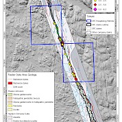
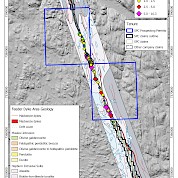
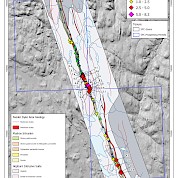
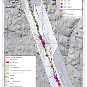
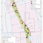
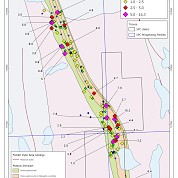
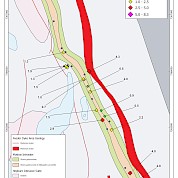
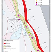
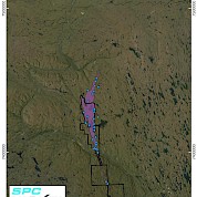
Maps and Figures


-
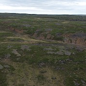
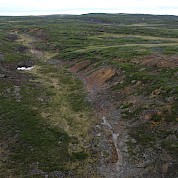
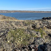
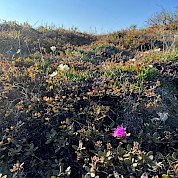
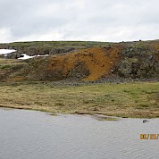
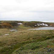
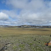
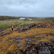
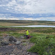
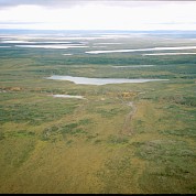
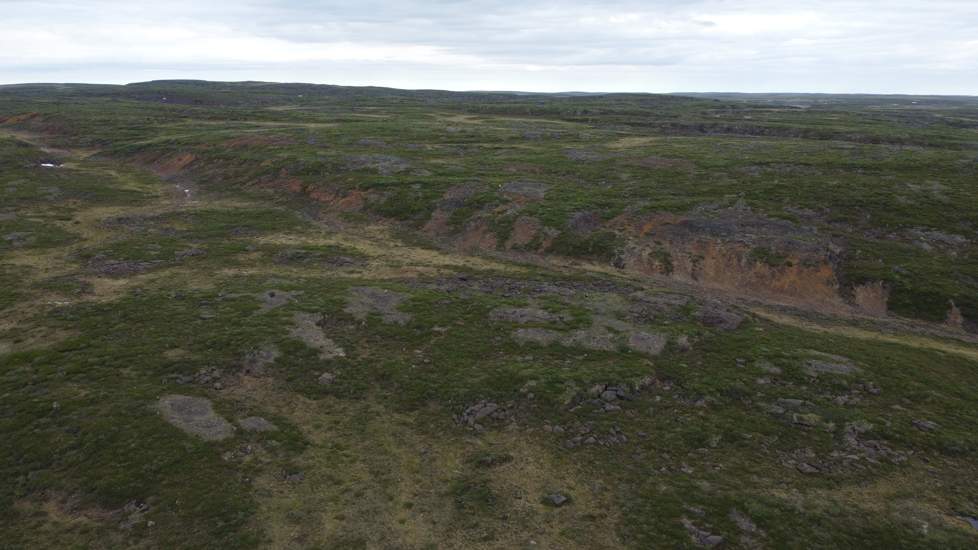
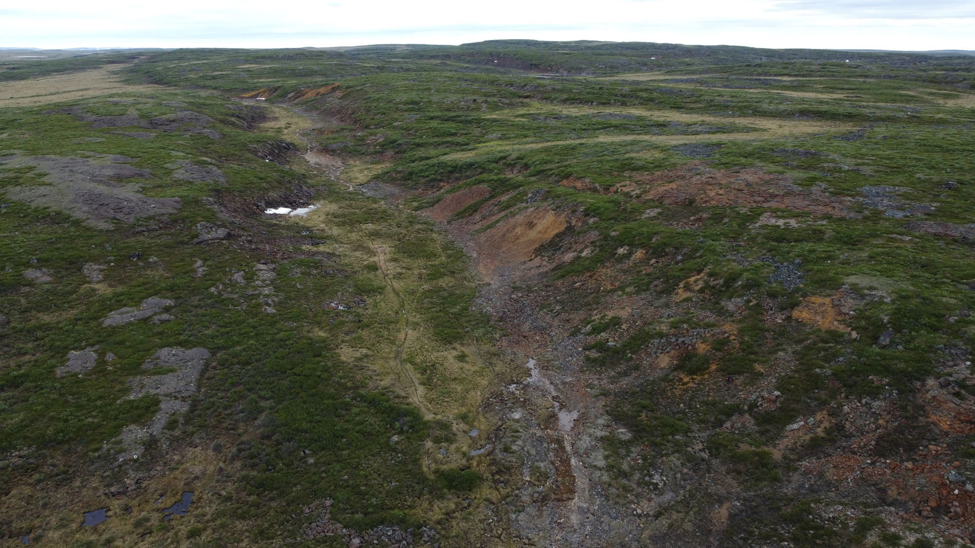
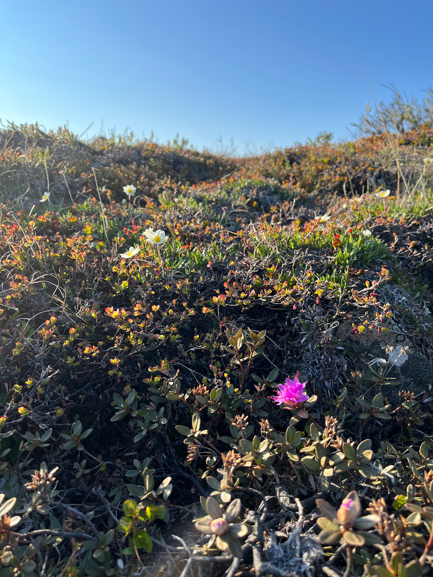
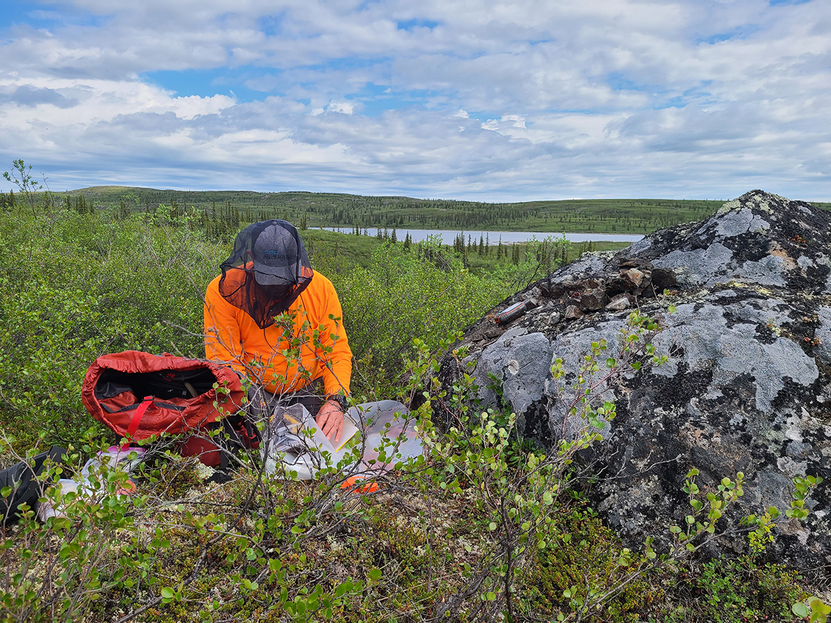
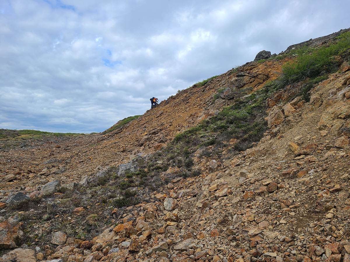
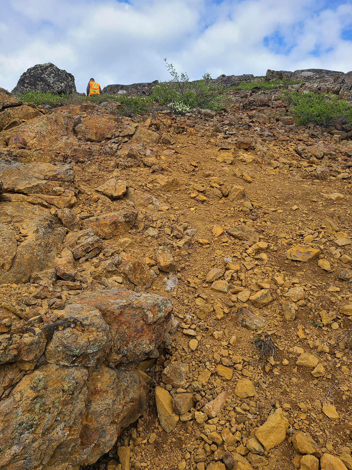
Photo Gallery